Dust, Cacti, and Jaw-Dropping Views: Cabo's Best-Kept Desert Trails
Most people picture Cabo San Lucas as a place of poolside margaritas and sunset cruises — and honestly, there's nothing wrong with that. But if you've ever looked out from your resort balcony and wondered what's lurking in those sun-scorched hills behind the hotel strip, you're already halfway to one of Baja's best-kept secrets.
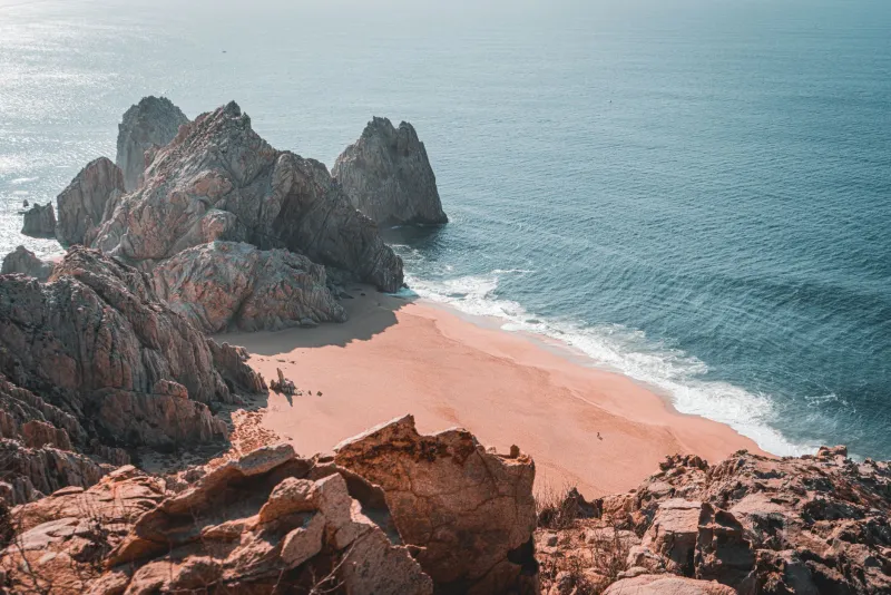
Cabo sits at the very tip of the Baja California Peninsula, where the Sonoran Desert doesn't just fade out — it crashes dramatically into the sea. That collision of ecosystems creates a landscape unlike anything else in North America: towering cardón cacti standing sentinel over turquoise water, bone-dry arroyos that empty straight onto sandy beaches, and ridgelines that offer views so cinematic they feel almost unfair. The trick is knowing where to look.
Why Most Tourists Miss It
The resort corridor along the Marina and Medano Beach is designed to keep you comfortable and contained — which is great for relaxing, but terrible for exploration. Uber drivers and tour operators default to the same handful of attractions, and unless you specifically ask about hiking, nobody's going to hand you a trail map at check-in.
That's your advantage. The trails out here are lightly trafficked, rarely crowded, and almost entirely free. You just need a little local knowledge and a willingness to get your sneakers dirty.
Trail Picks by Fitness Level
Easy: The Pedregal Overlook Path
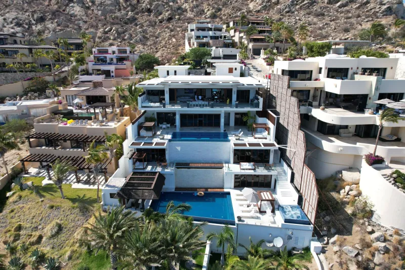
If you want big views without a brutal climb, the neighborhood of Pedregal — built into the rocky hillside just west of the Marina — offers paved and semi-paved walkways that wind up through luxury homes to open viewpoints. From the upper reaches, you'll get a sweeping panorama of Cabo's famous arch, El Arco, with the Pacific on one side and the Sea of Cortez on the other. Morning light here is absolutely stunning. Wear comfortable shoes, bring water, and allow about 45 minutes round-trip. This one's genuinely accessible for most fitness levels.
Moderate: Cerro de la Z
Locals call it "La Z" for the zigzag shape of the trail cut into the hillside above town. It's visible from the Marina if you know where to look — a pale scar of switchbacks on the rocky slope north of downtown. The hike takes roughly 60 to 90 minutes round-trip depending on your pace, with a steady but manageable elevation gain. At the top, you're rewarded with an unobstructed 360-degree view that takes in the full arc of the coastline, the marina below, and the vast desert interior stretching northward. Go early — by 9 a.m. the heat gets serious.
Challenging: The Sierra de la Laguna Foothills
For hikers craving something more remote, the foothills of the Sierra de la Laguna biosphere reserve — accessible via a short drive north of Cabo toward Todos Santos — offer multi-hour routes through dense desert scrub, dry creek beds, and elevated terrain that feels genuinely wild. These trails aren't formally marked, so going with a local guide is strongly recommended. Several small outfitters in Cabo offer half-day excursions into this zone. The payoff is extraordinary: high-desert silence, rare endemic plants, and views that stretch all the way to the Gulf.
Best Times to Hit the Trails
Timing is everything in the desert. From November through April, temperatures are mild and the light is soft — ideal conditions for both hiking and photography. Aim for a 6:30 or 7 a.m. start to beat the heat and catch golden-hour light on the landscape. Summer months (June through September) bring serious heat and humidity, and occasional tropical storms; if you're visiting in the off-season, stick to shorter routes and carry significantly more water than you think you'll need.
Sunset hikes are magical but require a headlamp and a trail you've already scouted in daylight. Don't attempt unfamiliar terrain in the dark.
Insider Tips for Photographers
Cabo's desert-meets-sea aesthetic is a photographer's dream, but capturing it well takes a little planning.
Shoot the transition zones. The most compelling images come from spots where desert vegetation — giant cardón cacti, palo blanco trees, ocotillo — frames a slice of deep blue water in the background. The Pedregal overlook and the upper slopes of Cerro de la Z both offer this composition naturally.
Chase the golden hours. Midday sun flattens everything and blows out the water's color. Sunrise and the hour before sunset transform the same landscape into something otherworldly, with warm light raking across the rock faces and long shadows defining every ridge.
Bring a polarizing filter. If you shoot with a DSLR or mirrorless camera, a circular polarizer will cut the glare off the water and saturate those blues in a way no editing app can fully replicate.
Watch for wildlife. The trails around Cabo are home to roadrunners, cactus wrens, iguanas, and the occasional rattlesnake. Keep your eyes open, stay on the path, and you'll find plenty of unexpected subjects.
What to Bring (Don't Skip This Part)
The desert here is beautiful but unforgiving. Even on a moderate trail, pack more water than feels necessary — at least two liters per person for anything over an hour. Sunscreen, a wide-brimmed hat, and lightweight long sleeves will save you from a painful sunburn. Closed-toe shoes are a must; sandals are an invitation for cactus spines. Let someone know your planned route and expected return time, especially on less-traveled paths.
And leave the trail the way you found it. These wild corners of Cabo are special precisely because they haven't been loved to death yet.
The Bigger Picture
There's something deeply satisfying about stepping off the well-worn tourist path and discovering that the real Cabo — the raw, sunbaked, strikingly beautiful one — is right there waiting. The resorts are wonderful. The beach clubs are a blast. But the version of this place that'll stick with you long after you're back home? That one's out on the trail, somewhere between a giant cactus and a perfect view of the sea.